
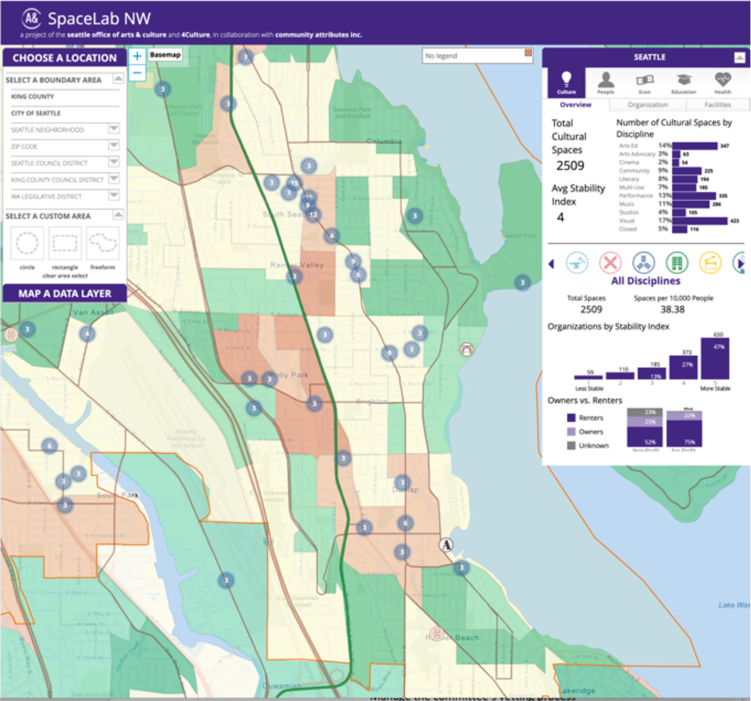
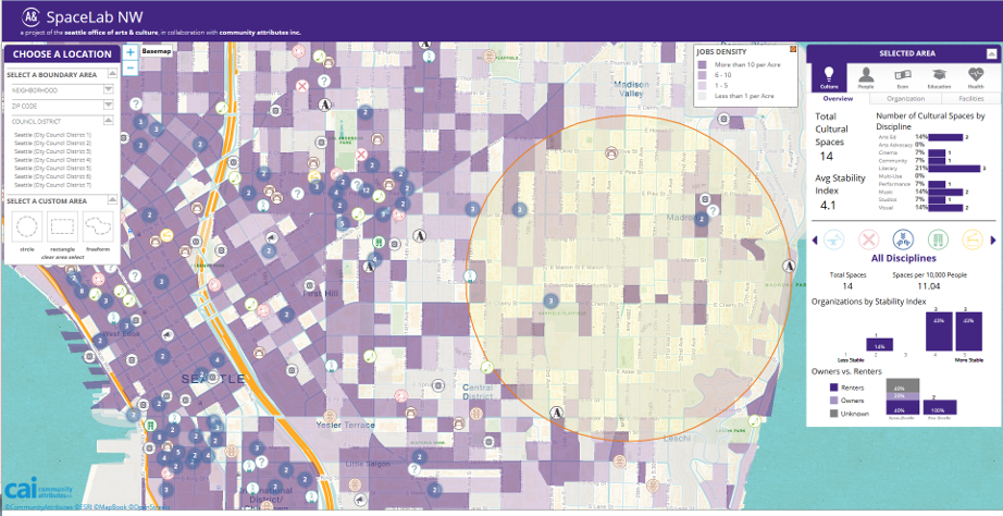
SpaceLab NW
a cultural space asset-mapping Geographic Information System
In 2014 I launched the SpaceLab NW project, an online cultural space asset map for both the City of Seattle and King County.
The project mapped over 1,200 cultural spaces and included over 30 data points for each space, including age of the building, number of square feet, employment levels, number of theater seats, racial and cultural identities, and more.
The map then correlated the presence of cultural spaces with locational data sets representing everything from poverty rates to job density to transit usage. The public-facing GIS site was active for the next decade, serving policy-makers and community members in mapping the impact of the creative economy.

Asset-Mapping
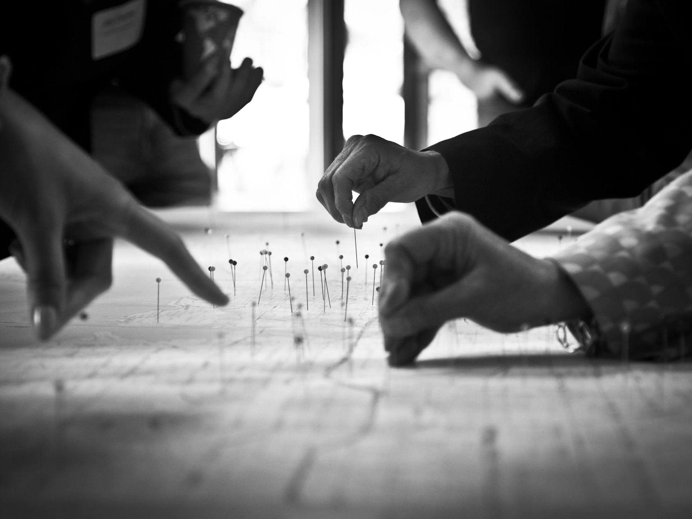
We worked with a team of Cultural Space Ambassadors to ensure that spaces embedded deep in cultural communities were not overlooked. We spent literally years collecting data on the sector, often updating spaces that had closed or opened since the launch of the project.
We tracked both quantifiable data on the real estate, as well as more quantitative data that captured the needs and concerns of the spaces and their operators.
The tool helped inform the development of cultural space policy at the City of Seattle for nearly a decade.